Seeing What Lies Beneath
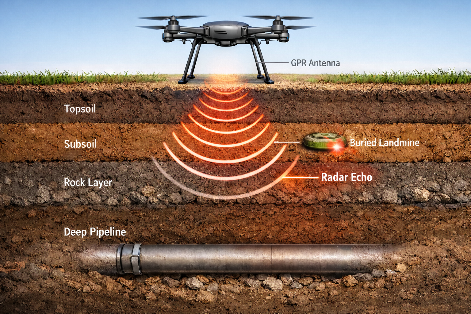
Ground-penetrating radar (GPR) transmits electromagnetic waves into the ground and records reflections from buried objects, material boundaries, and subsurface structures. These measurements can reveal features that are invisible at the surface, helping identify buried hazards and characterize subsurface conditions.
The challenge is that GPR data often contain strong surface reflections, background responses, and clutter that can obscure weaker targets. Furthermore, the shape and timing of radar reflections depend on the electromagnetic properties of the surrounding materials. Extracting useful information requires processing methods that account for both the physics of wave propagation and the statistical characteristics of the measured data.
Omega Sensing Technologies develops advanced GPR processing methods to improve subsurface imaging, estimate propagation properties, and recover weak target signatures in complex environments.
How It Works
Hyperbola-Based Matched Filtering and Velocity Estimation
Buried objects generate characteristic diffraction patterns in GPR data, with their geometry governed by wave propagation velocity and acquisition geometry. We develop localized, physics-informed matched filters that exploit these patterns to identify target responses and estimate propagation velocity directly from radar measurements, reducing reliance on manual interpretation and explicit hyperbola fitting.
Wavelet Analysis and Heterogeneous Media
Our research explores physics-based wavelet methods that capture the spatial and temporal structure of GPR diffraction responses. Combined with statistical signal processing, these methods aim to distinguish coherent target signatures from noise and clutter while supporting velocity estimation in heterogeneous subsurface environments, where conventional assumptions of uniform propagation velocity may be inadequate.
Imaging and Clutter Suppression
Velocity estimates support subsurface interpretation and can inform migration and other imaging methods used to focus reflected energy and localize buried features. We develop complementary processing techniques to suppress background responses and incoherent clutter while preserving weak, physically meaningful target signatures.
Applications
Infrastructure Assessment
Locating buried utilities and imaging subsurface features in pavement, concrete, and construction sites to support infrastructure evaluation and maintenance.
Humanitarian demining
Detecting and localizing landmines and buried ordnance to support safer humanitarian demining and route clearance. Drone-based GPR surveys offer the potential to cover hazardous or difficult-to-access areas while limiting personnel exposure.
Environmental and Geological Investigation
Imaging subsurface layers, buried structures, and material variations to support site assessment and near-surface characterization.
Planetary Exploration
Detecting subsurface hazards and characterizing regolith properties to support landing-site assessment, hazard avoidance, and safer planetary surface operations.